From Crater to Crater
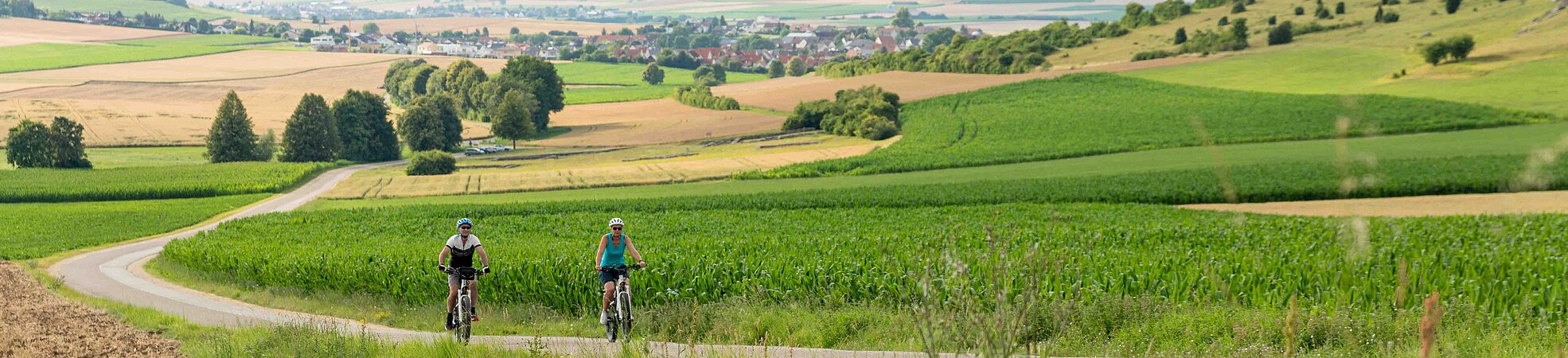
Route description: On a nearly 185-kilometer trail, the Geopark Ries cycling trail “From Crater to Crater” reveals the charming natural and cultural landscape of the eastern Swabian Alb and the Nördlinger Ries. The route connects the two impact craters Nördlinger Ries and Steinheim Basin. The bike path extends along two loops that intersect in Nördlingen.
Western route:
The trail runs from Nördlingen through Bopfingen, Steinheim and Neresheim and back to Nördlingen. It begins with a more challenging but extremely scenic segment from the Ries to the Steinheim Basin. From Baldingen, Goldburghausen and Kirchheim am Ries, the “From Crater to Crater“ bike path gradually ascends to the western edge of the Ries. Passing the distinctive elevations of the Blasienberg and Ipf hills, you reach Bopfingen. From there, the route continues through Aufhausen - Beuren to Elchingen. After traversing the Härtsfeld and a rapid descent to Oberkochen – past the Kocherursprung (spring, source of the Weißer Kocher) towards Königsbronn – the ascent to Zang follows. Shortly thereafter, you arrive at the intermediate destination of Steinheim in the Steinheim Basin.
In the second segment, follow the “From Crater to Crater“signage eastward up the crater rim. The route goes over the Schäfhalde through shaded forests to the Itzelberg lake. It then follows part of the Brenztal (Brenz river valley), ascending through the Möhntal (Möhn valley) towards Nattheim. The bike path continues through Fleinheim and Dischingen along the beautiful Egautal (Egau river valley) to the Härtsfeld lake and finally to Neresheim with its prominent, magnificent Baroque monastery church. After another ascent, the path leads to Maria Buch (a pilgrimage chapel) and onwards to Ohmenheim, Weilermerkingen, Dehlingen and Härtsfeldhausen. Soon a steep descent brings you into the Ries basin, passing Utzmemmingen and Nähermemmingen, reaching the stage destination of Nördlingen.
Eastern loop:
This route runs through Wemding, Oettingen, Maihingen und Wallerstein, crossing the expansive Ries plain. The trail gently curves through the flat Ries plain through Wemding and Oettingen, then back to Nördlingen. Heading out of town eastward, you first reach Deiningen, near the calculated impact center of the Ries asteroid, and shortly thereafter Alerheim. Passing the uplifts of the inner crater ring, the bike path crosses the Wörnitz river at the Wennenmühle (mill). The trail continues almost level to the eastern edge of the Ries rim at Wemding. Leaving the town northward, it passes the pilgrimage basilica Maria Brünnlein and wide meadows to Laub. From there, the route heads to Megesheim, Hainsfarth and Oettingen in the northern Ries, crossing the Wörnitz again. Heading westward, follow the signs through the fertile Ries landscape to Bettendorf, Heuberg and Maihingen, where the bike path turns south. Next, you reach Birkhausen, then the market town of Wallerstein, and finally return through Baldingen to the historic city of Nördlingen.
Diese Website nutzt Google Maps. Beim Aktivieren der Google Maps - Karte geben Sie Ihr Einverständnis, dass Inhalte von Google geladen und dadurch Ihre IP-Adresse an Google übertragen wird. Mehr Informationen und eine Möglichkeit zum Ein- und Ausschalten dieser Datenübertragung finden Sie in unserer Datenschutzerklärung. Wenn Sie die Goolge Maps – Karte jetzt ansehen möchten, klicken Sie auf Google Maps einblenden.
Brief Information
Total length: 190 km
Marking- Simple marking